define('WP_HOME', 'https://www.abbottabadclub.com');
define('WP_SITEURL', 'https://www.abbottabadclub.com');
MAPS - The Abbottabad Club
Skip to content
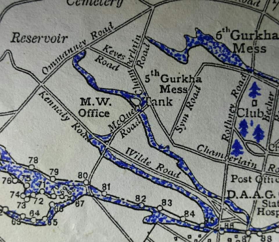
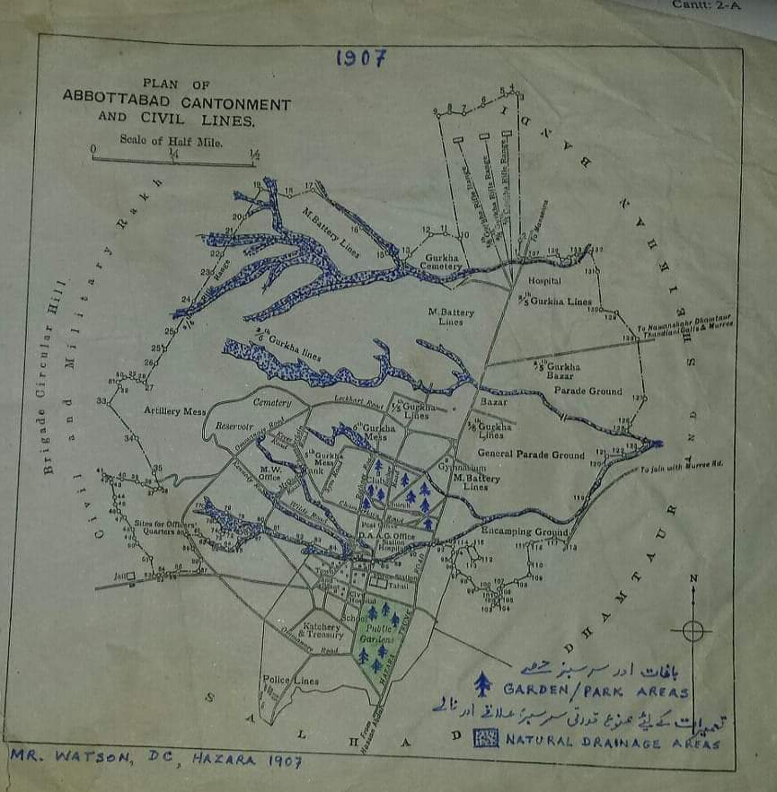
📌 Explore the Original Plan of Abbottabad Cantonment & Civil Lines
Step into the pages of history with these remarkable 1907 maps of Abbottabad, meticulously crafted under the supervision of Mr. Watson, DC Hazara. These rare cartographic treasures offer a glimpse into the city’s early urban planning, military significance, and civic layout at the height of the British Raj.
🗺️ Abbottabad in 1907
A Journey Back in Time
📌 Explore the Original Plan of Abbottabad Cantonment & Civil Lines
These are some fascinating architectural plans! Here’s a quick breakdown of what I see in the latest three images you shared:
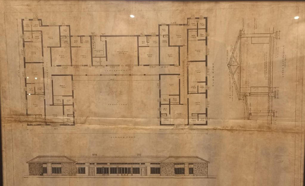
First Image:
It looks like another detailed floor plan for a building, probably related to the Abbottabad Club or a similar colonial-era structure. You can see distinct room labels, measurements, and annotations. The upper portion shows dimensions of rooms, probably for lodging or residential quarters. The lower portion might be sections and elevations, giving a view of how the building looks from outside or cross-sections showing structural elements. Second Image:
A cross-sectional diagram of a building. Shows detailed construction notes, including materials like stone walls, timber frames, and roofing specifications. There’s a roof truss design, showing structural engineering details. It looks like a continuation or companion drawing to earlier ones, focusing on architectural integrity and construction details. Third Image:
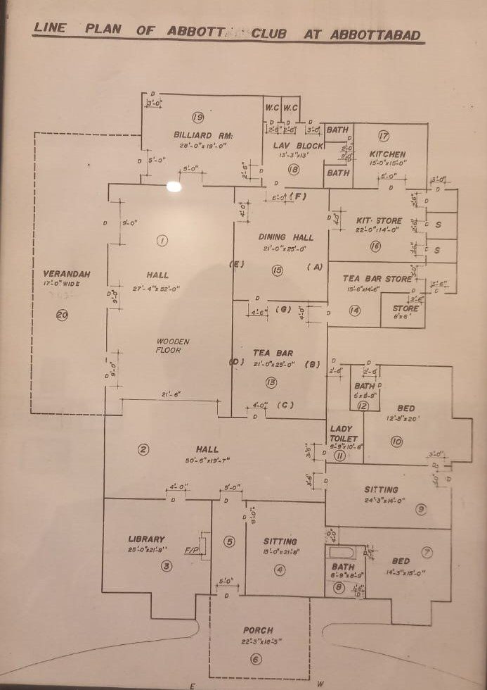
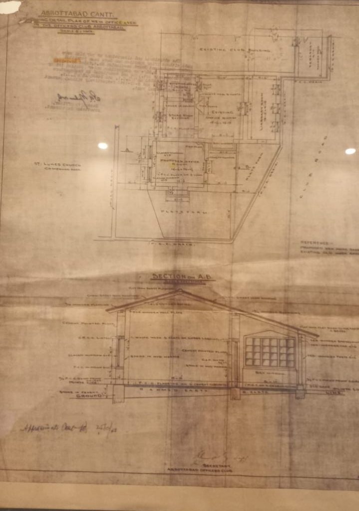
Another layout plan, with a sectional elevation at the bottom. Mentions of Abbottabad Cantt, Officers Club, and St. Luke’s Church nearby, giving context to the building’s location. It appears to be an approved engineering plan, with signatures and approval dates from what seems like 1941.